MAPS RELEVANT TO "AMA" and "BRAVE MUSIC of a DISTANT DRUM"
please click on the thumbnails for larger versions
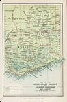 |
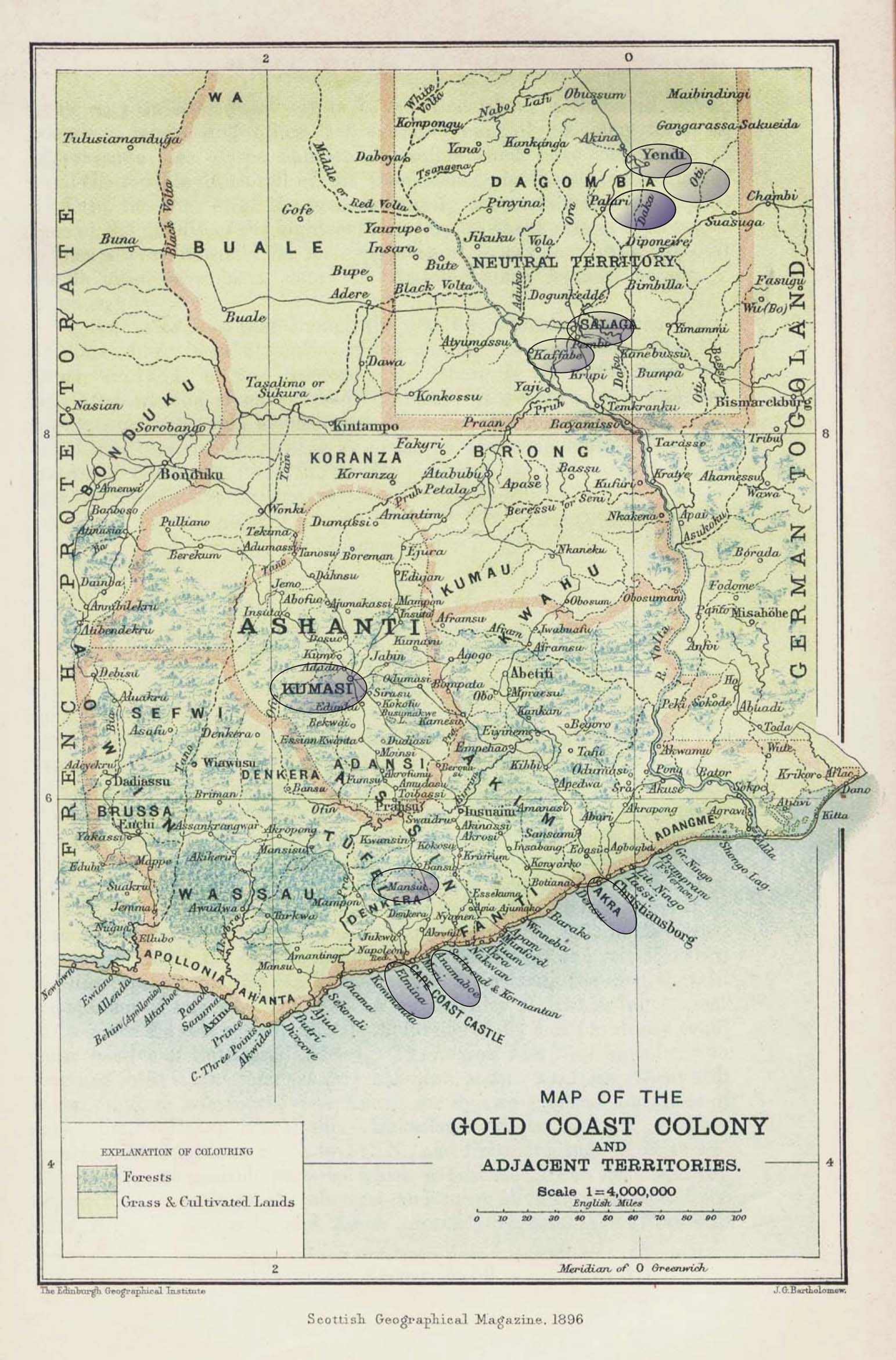
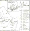
Map of Gold Coast Colony and Adjacent Territories, 1896
From the Scottish Geographical Magazine. Published by the Royal Scottish Geographical Society and edited by James Geikie and W.A. Taylor. Volume XII, 1896. 1896 was the year in which a British expeditionary force invaded Asante (with which it was not at war) and enforced a 'regime change' by abducting the Asantehene Prempeh I and transporting him successively to Elmina, Freetown and the Seychelles. He was not permitted to return to Kumase until 1924. Features and place names which appear in Ama are shown ringed. |
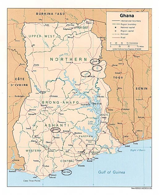
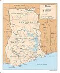 | Political map of Ghana, 1996 Features and place names which appear in Ama are shown ringed. The site of the original town on Kafaba has been submerged by the Volta Lake. Elmina is not shown but that town has certainly not been submerged. |
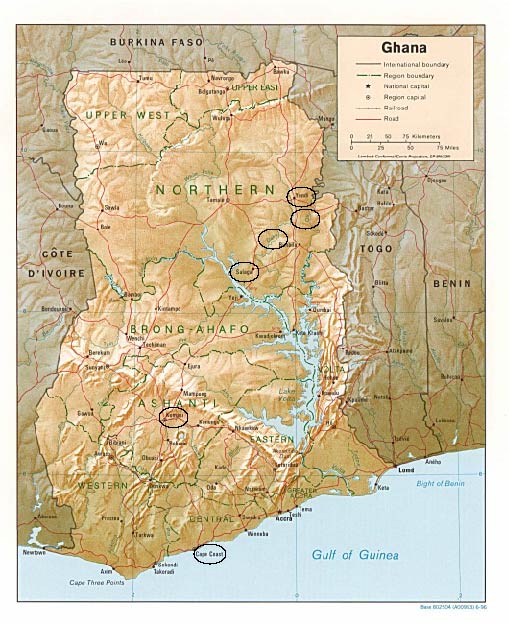
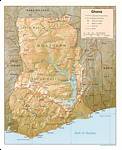 | Relief map of Ghana, 1996 Features and place names which appear in Ama are shown ringed. The site of the original town on Kafaba has been submerged by the Volta Lake. Elmina is not shown but that town has certainly not been submerged. |
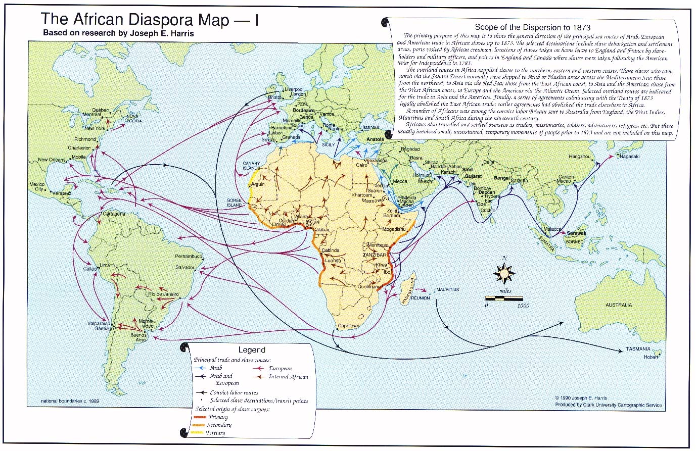
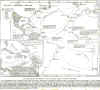
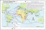 | Africa Diaspora Map based on research by Joseph E. Harris |
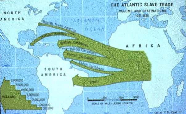
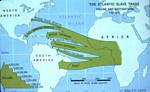 | The Atlantic Slave Trade, Volume and Destination, 1701-1819 (after P D Curtin) |
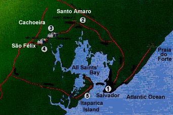
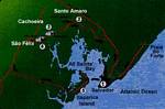 | Bahia (All Saints' Bay) Salvador is shown (1). Ama's fictional engenho might have been in the vicinity of Santa Amaro (2). |
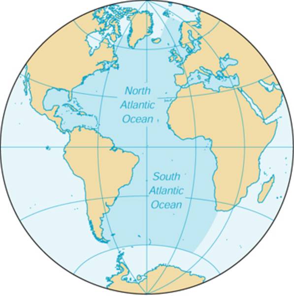
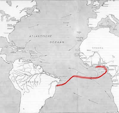
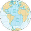 | The Atlantic Ocean |
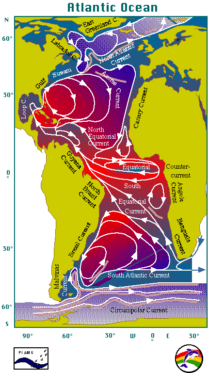
 | The Atlantic: Ocean Currents |
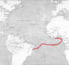 | The Love of Liberty's Middle Passage Showing prevailing winds
map from:
Van Dantzig, A, Het Nederlandse Aandeel in de Slawenhandel Fibula 1968 (in Dutch)
credit:Koninklijke Biblioteek, Den Haag |
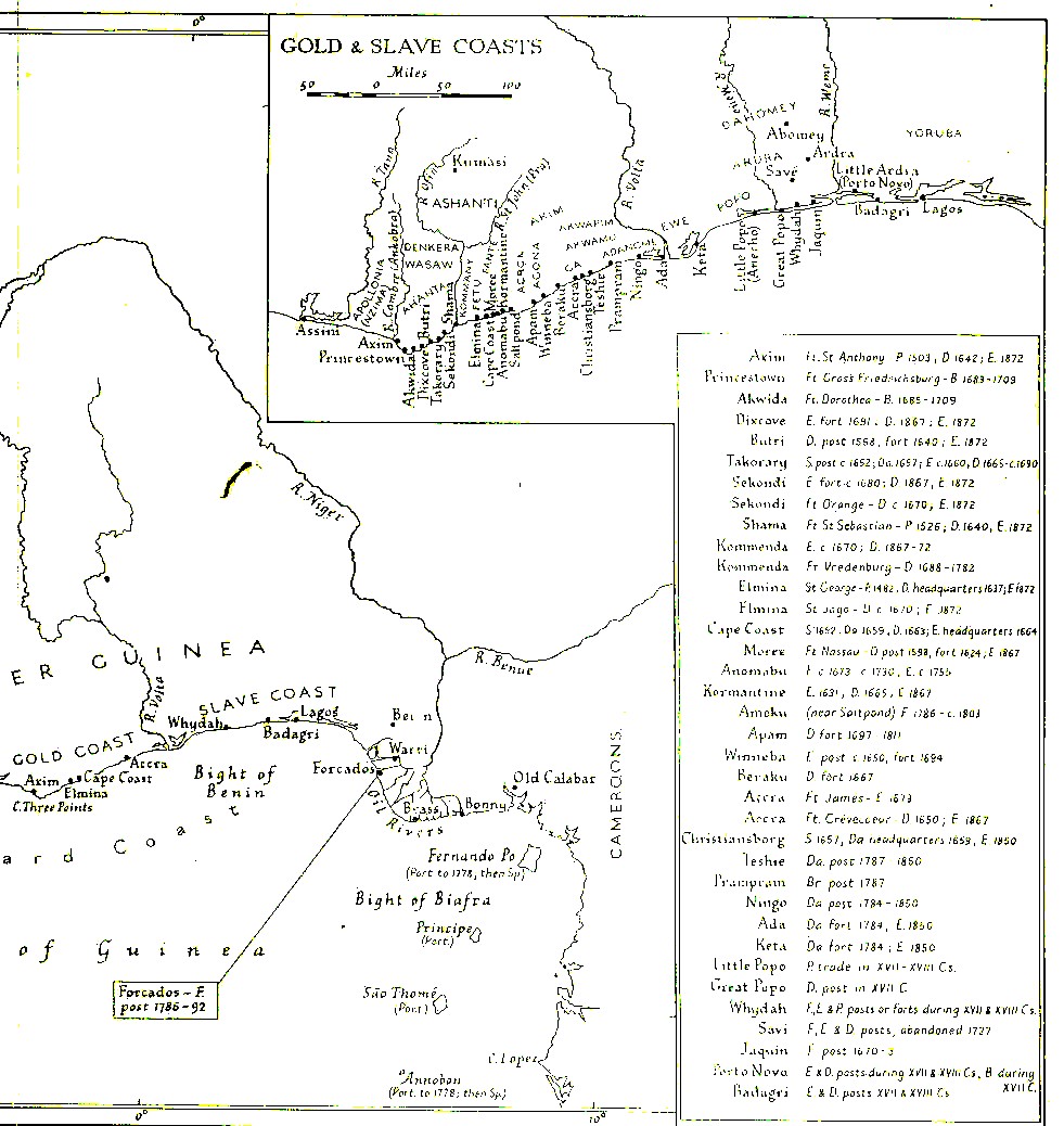
 | Gold and Slave Coasts, showing slave castles and forts (Sorry, I've mislaid the source.) |
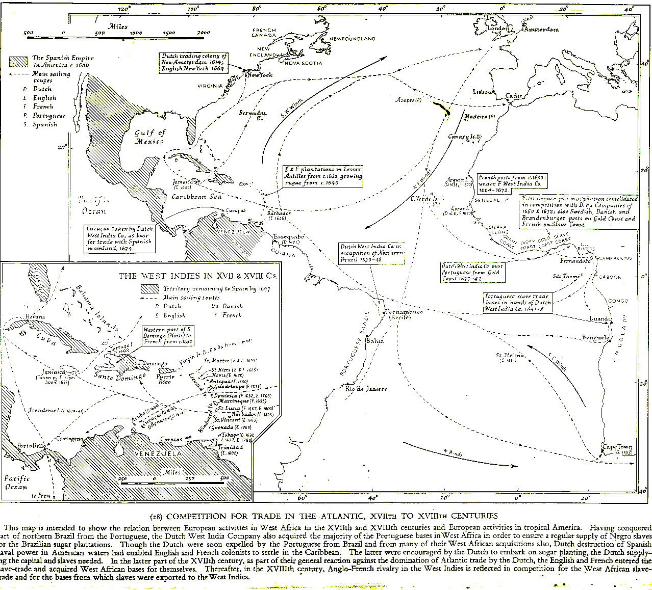
 | Competition for trade in the Atlantic, XVIIth to XVIIIth centuries. (Sorry, I've mislaid the source.) |
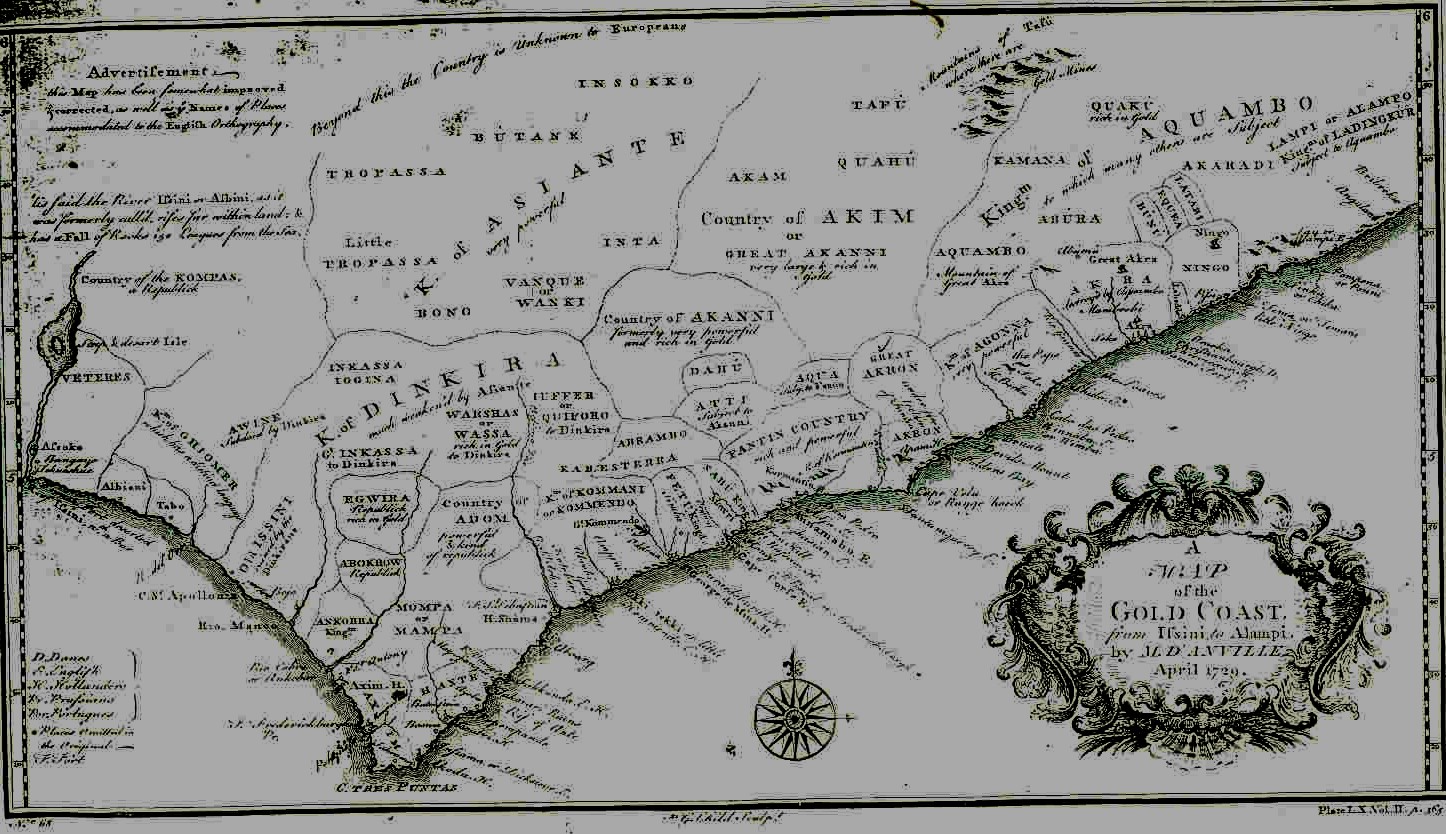
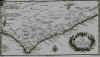 | A Map of the Gold Coast from Ifsini to Alampi by M.D'ANVILLE, April, 1729 |
LINKS
Maps of Africa http://www.indiana.edu/~origins/teach/P314/africamaps.html
Africa Data DisseminationService "this site lets you view or download topographic maps, referencemaps..., or data by country, region, or the entire... continent. "
http://earlywarning.usgs.gov/index.php
Maps-Ghana Historical Maps - Ghana, West Africa, Africa(C. Ladzekpo, University of California, Berkeley) http://www.cnmat.berkeley.edu/~ladzekpo/maps.html
Shaded Relief, 1996. (316K)
www.lib.utexas.edu/maps/africa/ghana_rel96.jpg
Seven maps of Ghana: political and shaded relief. From 1upTravel.com.
www.1uptravel.com/worldmaps/ghana.html
Topographical Map of Ghana
Regions, rivers and cities.
www.sas.upenn.edu/African_Studies/CIA_Maps/Ghana_1
West African Slave Trade Map
Map depicts the movement of Atlantic slave trade, indicating volume anddestinations from 1701 to 1810.
http://www.uwec.edu/Academic/Geography/Ivogeler/w111/slaves.htm
Map of Gold Coast Colony andAdjacent Territories, 1896 (315K)
From the Scottish Geographical Magazine. Published by the Royal ScottishGeographical Society and edited by James Geikie and W.A. Taylor. Volume XII,1896. Shows Yendi, Daka River, Kpembe (lookfor Salaga), Kaffaba, Volta River, Kumasi, Elmina, etc.
http://www.lib.utexas.edu/maps/historical/gold_coast_1896.jpg
TheAfrican Diaspora Maps I and II by Prof. Joseph E. Harris
http://artsedge.kennedy-center.org/aoi/resources/hg/ae-map.html